New Data pages: using Google Earth to identify looted sites
18 Jan 2013

The Data section of our website has some exciting new pages.
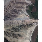
A suite of information, including methodologies, downloadable files, maps and images, has been added covering the use of Google Earth to identify looted archaeological sites, with case studies from Jordan and Peru. Have a browse through the Introduction, Methodology, Jordan, Images: Jordan, Chart and Tabular data: Jordan, Peru, Images: Peru, and Bibliography pages to find out more.
If you have used this methodology yourself, we are interested in hearing from you. If you have any other relevant forms of data that you would like to be considered for inclusion on our website, please do get in touch.
The data are taken from research originally supported by and conducted at Stanford Archaeology Center by Dan Contreras and Neil Brodie.
